Helicopter Tour Over Mount Agung Volcano
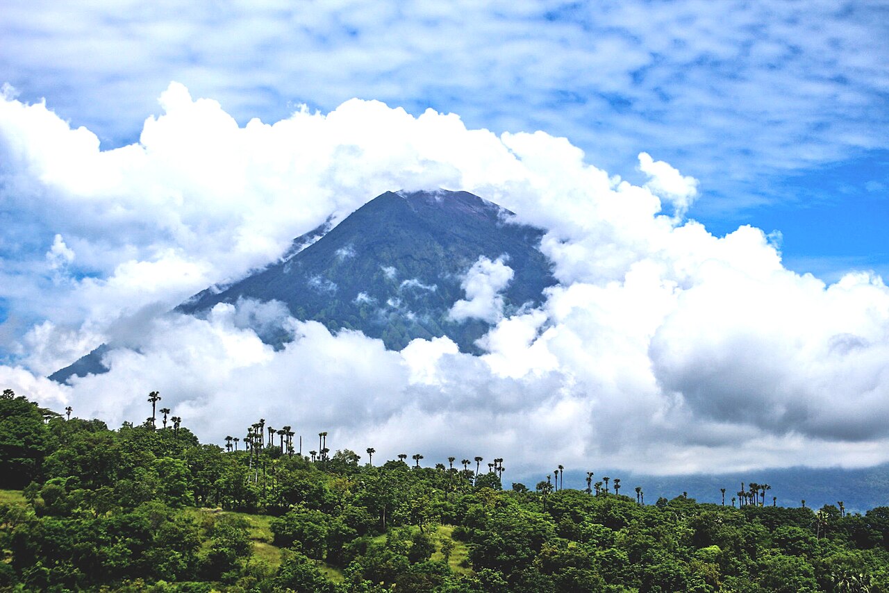
At 3,031 meters, Mount Agung is the highest point in Bali and the spiritual center of the island. The Balinese orient their homes and temples in relation to Agung. To fly around its summit is to understand why.
Book Helicopter TourFlying Over Mount Agung
Mount Agung is not just a mountain. For the Balinese, it is the navel of the world, the earthly representation of Mount Meru, the cosmic axis. Pura Besakih, the island's most important temple complex, clings to its southern slopes at 1,000 meters. The volcano last erupted in 2017 and 2018, leaving fresh lava fields visible on its flanks. From a helicopter at safe altitude, you see all of this: the summit crater, the temple complex, the lava trails, the dramatic transition from barren volcanic slopes to lush green valleys below.
The Summit and Crater
Mount Agung's summit is usually partially obscured by cloud, but on clear mornings — typically between 07:00 and 10:00 — the crater and upper slopes are fully visible. The summit crater is approximately 500 meters wide. Volcanic gases periodically vent from the crater floor, visible as faint plumes on still days. The upper mountain above 2,500 meters is bare rock and volcanic ash, stripped of vegetation by the repeated eruptions. The contrast between the stark summit and the forest that covers the lower slopes is dramatic from the air. On very clear days, the view from the summit altitude extends east to Lombok and Mount Rinjani across the Lombok Strait.
Pura Besakih: The Mother Temple
Pura Besakih is Bali's most sacred and most complex temple. It consists of 23 separate temples built in a series of terraces up the southern slope of Agung, between 900 and 1,000 meters altitude. The largest, Pura Penataran Agung, occupies the central position with its towering meru towers clearly visible from the air. The entire complex covers over 3 hectares and contains hundreds of shrines, gates, and ceremonial courtyards. From a helicopter, the full layout of the complex and its relationship to the mountain above it is immediately apparent in a way that is impossible to grasp from the ground.
The 2017-2018 Lava Fields
Mount Agung's most recent major eruption began in late 2017 and continued into 2018, producing lava flows and ash deposits on the northern and northwestern flanks. These fresh lava fields are still clearly visible from the air as dark gray and black channels cutting through the older vegetation. The contrast between the raw lava and the green forest that surrounds it illustrates the power and speed of volcanic eruptions. Some lava flows reached the sea on the north coast, creating small new promontories of black rock. Our Volcano & Lake Tour flight passes over these lava fields as part of the route.
The Eastern Approach and Candidasa Views
Flying toward Agung from the east, you cross the Candidasa and Amed coastlines before the mountain dominates the view. The eastern slopes of Agung descend in long ridges toward the coast, covered in a patchwork of rice terraces and forest. The village of Tirtagangga, with its ornate water palace and tiered fountains, is visible as a geometric water feature in the landscape. As you gain altitude approaching the mountain, the scale shifts and the coastline recedes. The Indonesian islands of Nusa Penida, Nusa Lembongan, and Lombok appear on the southern and eastern horizon.
Flight Details
Frequently Asked Questions
Is it safe to fly near an active volcano?
Yes. We monitor volcanic activity alerts from the Indonesian Centre for Volcanology (PVMBG) before every flight. We fly at safe distances from the crater and adjust our route based on current alert levels. If conditions are not safe for a volcano overflight, we will modify the route or reschedule at no charge.
Can I see inside the crater of Mount Agung?
On clear mornings when the crater rim is free of cloud, you can see into the upper crater from helicopter altitude. The view into the crater depends on weather and visibility. We approach the mountain from the south and southwest, which gives the best angle on the crater and the Besakih temple complex simultaneously.
What other landmarks does the Volcano & Lake Tour include?
The Volcano & Lake Tour (45 min, $380) covers Mount Agung, Pura Besakih, the Kintamani highlands, Lake Batur, Mount Batur, and the Batur caldera. It is the most geologically dramatic flight we offer.
What is the best time of year to fly near Mount Agung?
The dry season from May to September offers the most consistent clear conditions. During the wet season (November to March), morning flights before 09:00 usually give the clearest views before cloud builds around the summit. April and October are transitional months with variable conditions.
Book a Flight to Mount Agung
Send us a WhatsApp message and we'll confirm availability within minutes.
Book via WhatsAppTours That Fly Over Mount Agung

See Mount Agung from a Helicopter
Book your aerial tour and experience this destination like never before.
Book on WhatsApp